

Solitude and Sniffing in New Hampshire
This column is the second in a series documenting the journey of FEDmanager and FEDagent Editor Maya Meltsner and her dog Huey, who are currently traveling the country in an RV to explore the federal government’s presence in each of the fifty states.
This column is brought to you by WAEPA (Worldwide Assurance for Employees of Public Agencies).

Our trip to New Hampshire began with silence. Not the good kind of silence. The kind of silence that comes with turning the key in the ignition and hearing nary a sputter. I had been having trouble with the starter of my RV but thought the problem had been fixed. I tried again and again to turn the engine over, to no avail. After calling AAA to get a jump and contemplating my situation for a while, I tried again. Much to my chagrin, I realized that the RV had been in reverse the whole time. I put it in park, turned the key again, and the engine roared to life. We were off!
Our destination was the White Mountain National Forest (WMNF), which is overseen by the Forest Service, a branch of the USDA. Due to our later-than-planned exit from Maine, the sun was setting as we crossed into the forest. To my delight, I spotted a pair of moose along the side of the road. I pulled over to get a better look. Huey continued napping in the passenger seat, which was probably for the best, as I do not know how he would react to such large creatures. The moose, which seemed to be a mother and adolescent based on their size and lack of antlers, munched on the roadside vegetation and seemed unfazed by the few vehicles that zoomed by. The many ‘Moose Crossing’ warning signs that we had passed were evidently prescient.

Just to the right of the road you can make out the moose we saw.
Although I could have watched the moose for hours, we needed to get to our campsite for the night. We were heading for the Gale River Loop Road, a forest service road with a number of pullouts available for free camping. Per Forest Service guidelines, visitors can stay for up to fourteen days at one of these amenity-free sites. In the dark, we found one that just fit my 21-foot RV. We fell asleep to the sound of leaves rustling in the trees and the distant gurgling of the Gale River.
By the light of morning, we surveyed the area where we would spend the next few days. The well-maintained dirt road had about a dozen campsites, two trailheads, and a number of gated roads leading further into the woods. Huey and I walked down one of these roads for a while (the sign beside the gate said foot traffic was welcome) but turned around before we reached the end. Even in the middle of the week, many other campsites were occupied and the trailheads saw a fair amount of traffic. I was amazed that we could stay for free on such beautiful public land.
A signpost by each designated camping area warned about black bear activity and forbid leaving food and garbage in the open, citing CFR 261.58.cc. I was hoping that part of the Code of Federal Regulations made specific reference to curtailing bear activity, but it turns out it just prohibits “possessing or storing any food or refuse, as specified in the order.” Huey and I followed these instructions to the letter and did not see any ursine tracks, droppings, or bears themselves during our stay.
In order to take full advantage of the recreational opportunities available in the WMNF, we took a hike up Mt. Garfield on one of the trails down the road from our camp. Consulting my map as we left, I saw that we would remain on the same trail for essentially the entire hike. The trail, which the Forest Service maintains in conjunction with the Appalachian Mountain Club, wound its way across a few streams and began an easy(ish) climb up the mountain with many switchbacks. Huey spotted many squirrels, chipmunks, and who knows what else in the undergrowth.
The real climb began about a quarter of a mile from the top. We came to a junction, where, much to Huey’s delight, another hiker offered him an entire Slim Jim. I thought at the time that trails continued to our left and right as well as straight to the summit. Based on my cursory look at the map earlier and my distraction at meeting another human for the first time all day, I remained confident in my understanding that there was one path to the summit that joined other trails at the junction. Full of Slim Jim, we continued straight up a series of rock scrambles to the exposed summit. In addition to sweeping 360-degree views, the summit housed the remnants of an old fire tower. Due to advances in technology, the Forest Service no longer needs fire towers to monitor the forest and instead can use satellite imagery and drones.

Huey enjoys the view from the summit of Mt. Garfield.
After a brief nap in the sun (taken by Huey), we began our descent. My first clue that something was wrong should have been when we immediately passed a sign informing us that we were leaving the Forest Protection Area (FPA) surrounding the Garfield Ridge Campsite. Forest Protection Areas, as designated by the Forest Service, provide a quarter-mile radius around trailheads, campsites, or other points in which unauthorized camping, building fires, and other actions are prohibited due to the potential of overuse. We should have been heading back into the FPA, as the campsite was down the trail at the junction we had passed earlier. However, as I believed that there was only one trail leading to and from the summit, we pressed on down the steep, rocky trail. (If I had one piece of feedback for the Forest Service, it would be to provide better signage on Mt. Garfield).
After hiking for about half an hour and still not reaching the junction we had passed earlier, another hiker and I began to feel that we were going in the wrong direction. He had a GPS map on his phone that showed us on a different trail. I consulted my paper map and confirmed that we were indeed going in the wrong direction when I identified a pond (that neither of us remembered seeing on the way up) as one alongside wrong trail. Remember the junction that I mentioned earlier? Well, it turns out that the trail that I thought led to the right was in fact just a worn-down patch of brush and not a trail at all, meaning that the trail leading to the right on my map in fact left the summit of Mt. Garfield. We were on that trail and heading, not back to the base of Mt. Garfield where we started, but to another series of mountains! We had been descending rather steeply for about a mile, meaning that we now had to ascend back to the summit to get on the correct trail.
Huey immediately embraced this turn of events and began bounding his way up the rocks. As we were now about six miles into what had turned into a twelve-mile hike and had to hike the hardest part all over again, I began to tire and had to take more breaks. Huey would jump as far ahead as his leash would allow and then turn to look at me and silently beg me to hurry up. He insisted on climbing all the way back to the tippy-top of the summit (probably looking for more Slim Jims) before we located the trail we were meant to be on and climbed back down. We eventually made it back to the RV and took a long nap.
We spent the next day or so recovering from the hike by mostly sitting and enjoying the solitude of our campsite. Because the batteries of my various devices kept dying overnight in the cold (as it got down into the 30s) and the sky was too overcast for me to successfully use my solar panel to collect energy, we ventured into the town of Gorham, which is nestled in the WMNF, to recharge.
Serendipitously, as I was sitting working in a café, I overheard a woman inquire at the counter about the status of several apartments in the building. The woman identified herself as an employee of the Census Bureau who was checking on the status of the building in preparation for next year’s big count. My ears immediately perked up (a federal employee! Yes!) and I somewhat awkwardly approached her as she was leaving to glean some information from her and explain my project. She explained that she was a temporary employee of the Census Bureau, working a 45-day stint driving around confirming that buildings are either businesses or residences based on data from previous censuses. In buildings such as the café, which houses both, it would be difficult to tell from satellite imagery or other remote methods if there are residents. Her work helps ensure that the data collection for the census next year will be accurate. She is one of many temporary employees performing this important preparation work. The Census Bureau hires hundreds of thousands of temporary employees for address canvasing and other duties to complete every census.
Huey and I drove north from Gorham to the town of Berlin, NH. Along our route we saw multiple signs that advertised open positions at our next destination: FCI Berlin. FCI Berlin is a medium security federal correctional institution overseen by the Federal Bureau of Prisons (BOP). The prison grounds, as expected, were replete with stern ‘No Trespassing’ signs. Not wanting to cause any trouble and merely wishing to acknowledge that BOP employs a significant number of federal workers in NH, Huey and I just snapped a quick picture of the sign as we drove by.
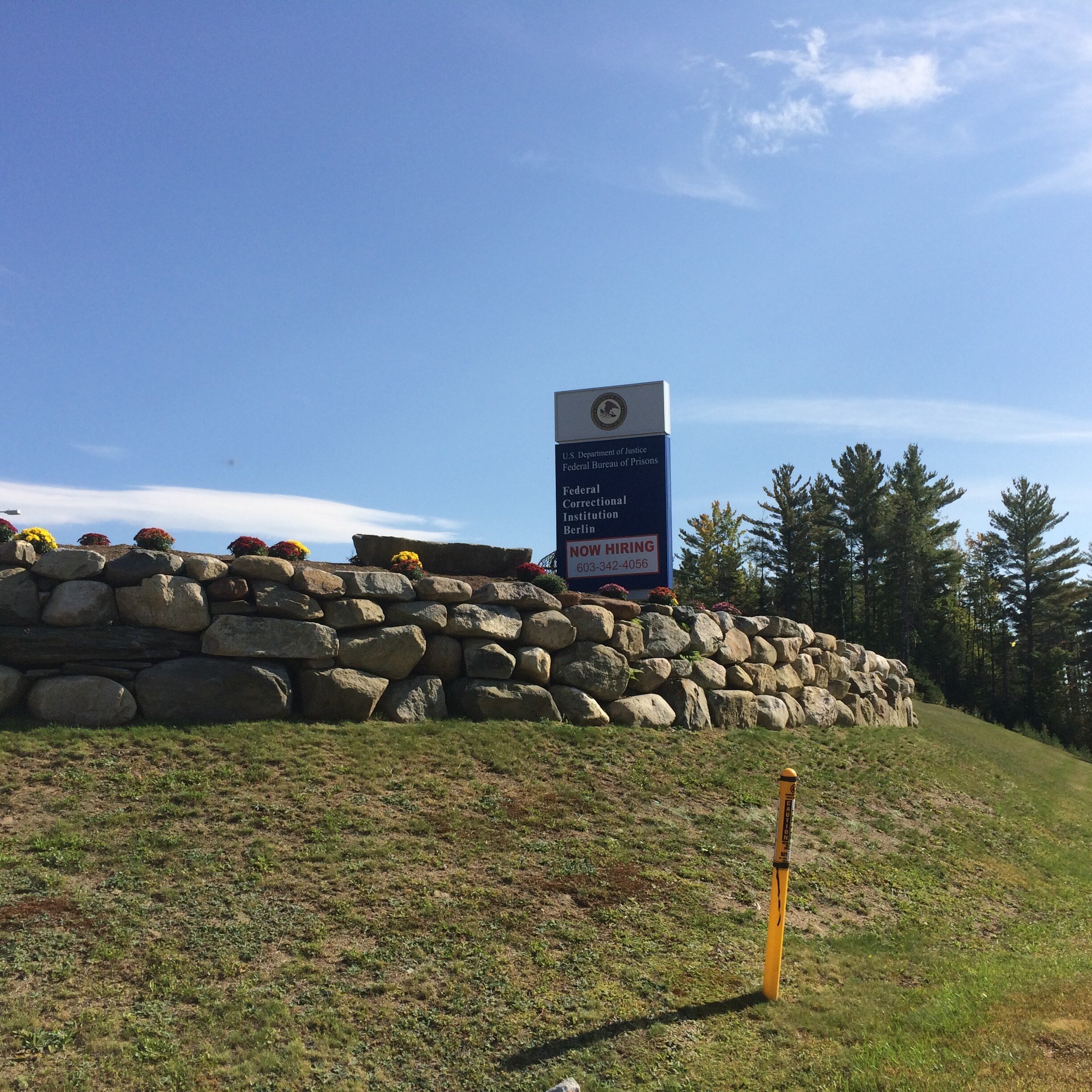
The sign outside FCI Berlin.
We concluded our visit to New Hampshire by staying on another forest service road, the Kilkenny Loop Road. Like the Gale River Loop Road, the Kilkenny Loop Road offered us a free place to camp for up to 14 days. We spent a relaxing weekend admiring the beginnings of fall foliage and scouting for wild animals. Based on his intense bouts of sniffing, Huey definitely found some, although his leash prevented him from getting too close. I spotted a baby garter snake, which, luckily, was the fiercest thing we encountered.

Huey explores Kilkenny Loop Road.
When we left the forest, we passed a sign that read “Leaving White Mountain National Forest: Land of Many Uses.” We had indeed seen and experienced many of these uses. The Gale River, which we camped near for several days, provided water to nearby towns. Through camping and hiking we met others who used the land for recreational purposes. We heard sounds of logging and passed piles of trees during our drives. The Kilkenny Loop Road was near a fish hatchery on forest service land. The towns we passed through used the natural resources of the forest and the recreational opportunities it provided to build their economies.
Our time in New Hampshire cemented my appreciation for access to public lands. The fact that we only had to pay for accommodation for one night during our week in New Hampshire amazed me. In our self-contained little home Huey and I were able to stay in the heart of the forest and benefit from the protected status of the land and its capable management. We enjoyed our time in the state and next moved on to a slightly more urban adventure in Vermont.
You can follow our journey in this column and by checking out our Huey-centric Instagram page @federalfifty. Please send us any comments or suggestions for future stops here.
WAEPA has been insuring the future of Civilian Federal Employees for more than 75 years.
Consider switching your FEGLI coverage to WAEPA Group Term Life Insurance. WAEPA offers rates up to 89% less than FEGLI, fully portable coverage, and exclusive member perks. See why more than 46,000 Feds have already switched at waepa.org.